Archaeology on steroids

The remains of a major new prehistoric stone monument have been discovered less than 3 kilometres from Stonehenge.
Using cutting edge, multi-sensor technologies the Stonehenge Hidden Landscapes Project, including the University of St Andrews’ Dr Richard Bates, has revealed evidence for a large stone monument hidden beneath the bank of the later Durrington Walls ‘super-henge’.
Durrington Walls is one of the largest known henge monuments measuring 500 metres in diameter and thought to have been built around 4500 years ago. Measuring more than 1.5 kilometres in circumference, it is surrounded by a ditch up to 17.6 metres wide and an outer bank c40 metres wide, and is surviving up to a height of 1 metres. The henge surrounds several smaller enclosures and timber circles and is associated with a recently excavated later Neolithic settlement.
The Stonehenge Hidden Landscapes Project team, using non-invasive geophysical prospection and remote sensing technologies, has now discovered evidence for a row of up to 90 standing stones, some of which may have originally measured up to 4.5 metres in height. Many of these stones have survived because they were pushed over and the massive bank of the later henge raised over the recumbent stones or the pits in which they stood. Hidden for millennia, only the use of cutting edge technologies has allowed archaeologists to reveal their presence without the need for excavation. 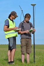
Dr Bates said: “Working on these sites is such a privilege – the new and improved geophysical techniques are providing the opportunity to investigate the landscapes with incredible detail revealing buried evidence of the past environments and monuments in a way that we could only dream of 10 years ago. Academically we can learn so much more about our ancestors now but the geophysics is also giving us new ways to share the discoveries and hopefully inspire a new generation to become interested in archaeology.”
At Durrington, more than 4.5 thousand years ago, a natural depression near the river Avon appears to have been accentuated by a chalk cut scarp and then delineated on the southern side by the row of massive stones. Essentially forming a C-shaped ‘arena’, the monument may have surrounded traces of springs and a dry valley leading from there into the Avon. Although none of the stones have yet been excavated a unique sarsen standing stone, ‘The Cuckoo Stone’, remains in the adjacent field and this suggests that other stones may have come from local sources.
Previous, intensive study of the area around Stonehenge had led archaeologists to believe that only Stonehenge and a smaller henge at the end of the Stonehenge Avenue possessed significant stone structures. The latest surveys now provide evidence that Stonehenge’s largest neighbour, Durrington Walls, had an earlier phase which included a large row of standing stones probably of local origin: the context of the preservation of these stones is exceptional and the configuration unique to British archaeology.

This new discovery has significant implications for our understanding of Stonehenge and its landscape setting. The earthwork enclosure at Durrington Walls was built about a century after the Stonehenge sarsen circle (in the 27th century BC), but the new stone row could well be contemporary with or earlier than this. Not only does this new evidence demonstrate an early phase of monumental architecture at one of the greatest ceremonial sites in prehistoric Europe, it also raises significant questions about the landscape the builders of Stonehenge inhabited and how they changed this with new monument-building during the third millennium BC.
Vince Gaffney, an archaeologist at Bradford University who leads the Stonehenge Hidden Landscape project, said: “What we are starting to see is the largest surviving stone monument, preserved underneath a bank, that has ever been discovered in Britain and possibly in Europe. This is archaeology on steroids.
“Everything written previously about the Stonehenge landscape and the ancient monuments within it will need to be re-written,” added Paul Garwood, Senior Lecturer in Archaeology at the University of Birmingham, and the principal prehistorian on the project.
Captions:
Image 1: ‘Radar’ scans the new site
Image 2: Using GPS on the site
Image 3: CGI simulation of the new stone row
Notes to news editors
For images visit: http://www.lbiarchpro-imagery.at/stonehenge2015
Dr Richard Bates is available for interview. Please contact the University of St Andrews Press Office to arrange on 01334 462 167 or email [email protected]
The Stonehenge Hidden Landscapes Project is an international collaboration between the University of Birmingham and the Ludwig Boltzmann Institute for Archaeological Prospection and Virtual Archaeology (LBI ArchPro) and led by Professor Wolfgang Neubauer and Professor Vincent Gaffney (University of Bradford). As part of the project, experts from many different fields and institutions have been examining the area around Stonehenge revealing new and previously known sites in unprecedented detail and transforming our knowledge of this iconic landscape.
For background see ‘Super Henge unveiled‘:
Category Research